
In the face of an increasingly volatile climate and rising sea levels, allowing the Scheldt to overflow in a controlled way and reconnect with the land has created a chain of wetlands that bring benefits to the local communities and an array of flora and fauna.
Taming the tide
The dynamism of this Belgian tidal river and its tributaries was not always welcomed, with a devastating storm surge in 1976 severely flooding the Flanders region. Better flood protection and management was promised shortly after, and the Sigma Plan was born. It is an inspiring initiative that will span over 50 years, protecting a large part of Flanders from flooding, and will create 14,000 hectares of connected nature-friendly habitats by 2030 – enabling the migration of fish and the free movement of recently recolonised species such as otter and beaver following decades of absence. The Sigma Plan has developed alongside our developing knowledge of how inextricably linked we are with nature. It is a plan that works with it, not against it.
‘The Sigma Plan is a unique integration of water safety and nature development, and we are thrilled to share our knowledge and experience with the ERN members.’ – says Sigma Plan’s Project Leader, Veerle Campens.
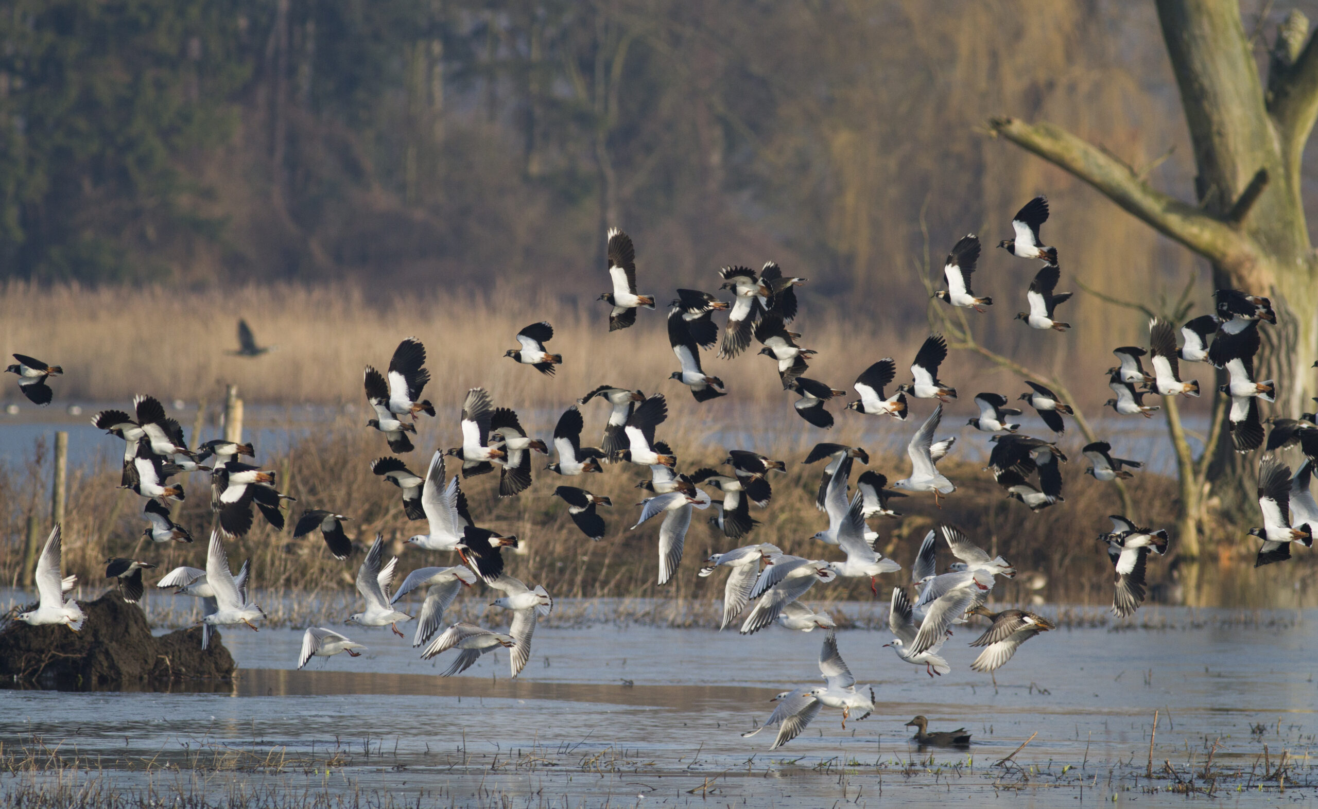
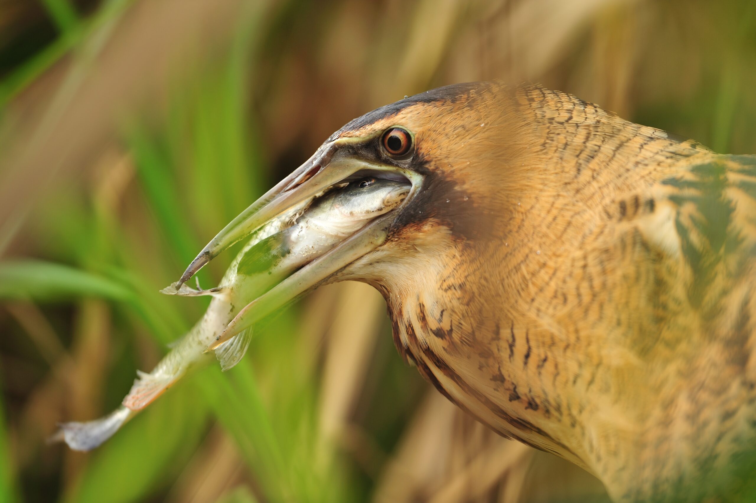
In the Polders van Kruibeke, alder swamp forest and its creeks have been rejuvenated into a paradise for kingfisher, purple heron, pike, bluethroat and the spined loach. This area is a vast re-wetted floodplain of tidal nature, marshland and swamp forests that’s now home to a profusion of wild flowers and insect life. Combining managed overflow areas with strengthened dyke protection, a web of land is protected from extreme rainfall and tidal inundations, while letting the natural rhythms of the tides breathe new life into the surrounding countryside – sprouting new growth, boosting biodiversity and creating a new nature reserve for people to enjoy.
A dynamic environment
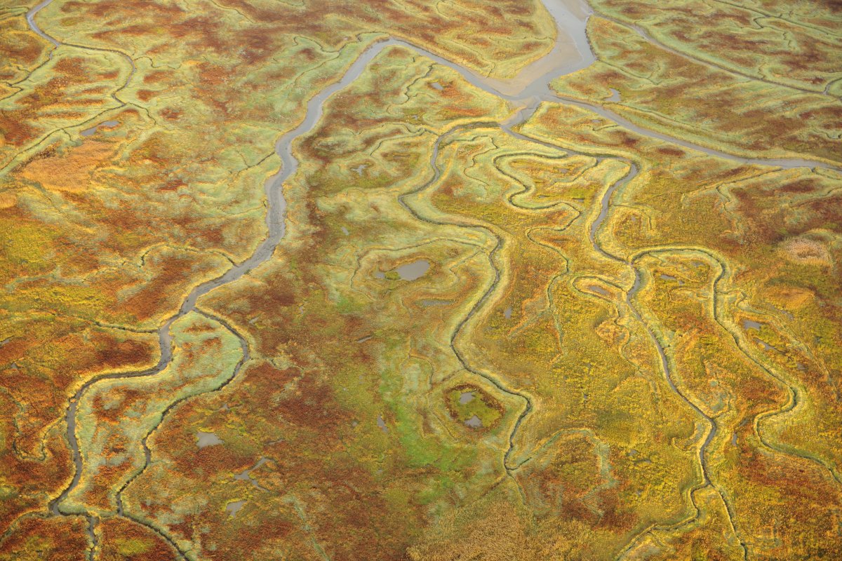
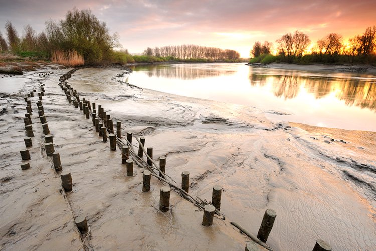
When Scheldt water flows into and out of an area twice a day, a tidal nature area develops with mudflats and marshes. An ebb and flow occurs between fresh and saltwater, creating an interplay between water, sand and silt. It is a world of fluidity and contrasts; the river carving out a network of mudflats, shoals, marshes, channels and brooks – an intricate collection of habitat niches. Polders are given back to the river and new dykes are built further inland.
The salty and fresh water mudflats teem with worms, crabs, crayfish and waders. As the silt left by each tide builds up, marshes of varying heights form that support sea lavender, reeds and vanishingly rare tidal willow forests. Open expanses of wetland merge into marsh forest – prime nesting sites for many bird species. Where grazing or mowing occurs, natural grasslands emerge, freed from intensive agriculture and revitalised by a rise in water levels during the spring. Ditches, brooks and pools provide sought after spots for dragonflies, amphibians and fish.
Nature’s services
Mudflats and marshes are extremely beneficial. They form natural buffers that protect us against flooding and erosion. They collect sand and sludge and purify the water. The wetlands have become a precious store of rainwater in recent years, with long periods of drought endured in the summer. And collectively, these habitats will become substantial sponges for absorbing carbon in densely populated areas, as well as being bearers of wellbeing and nature tourism – flood control bringing economic opportunities as well as more wildlife.
A decade of future habitat development
Between now and 2030 groundwater levels and inundation regimes will drastically change in the valleys of the Schelde’s tributaries, as Programme Coordinator, Lieven Nachtergale explains: ‘In the valleys of Grote en Kleine Nete for example, more than 1,000 hectares of natural grasslands and reed marshes will be created. In the Demer valley, 30 meanders will be re-established, combined with the creation of new marshland, forest, more open areas of scrub and re-wetted grasslands.’
To restore the ecosystem of the river Scheldt the area of tidal marshes needs to increase by 2,000 hectares, with alluvial forests restored on a large scale alongside a variety of wetlands, creating fertile conditions for viable populations of species such as bittern, corncrake, otter, beaver and great loach to thrive. The Sigma Plan’s long-term restoration results are already on show and the multi-faceted depth of their work will be of great value to Rewilding Europe’s knowledge exchange as more sites grapple with the prospect of increased flooding and the extremes of weather.
A platform for exchange
![]() Today rewilding is gaining momentum as a progressive and effective approach to conservation in Europe. Underpinning this trend, the burgeoning European Rewilding Network continues to foster collaboration and amplify results.
Today rewilding is gaining momentum as a progressive and effective approach to conservation in Europe. Underpinning this trend, the burgeoning European Rewilding Network continues to foster collaboration and amplify results.
Founded by Rewilding Europe in 2013, the aim of the ERN is to enhance the efforts of each member by facilitating the exchange of skills, insight and experience. Members meet regularly, usually via webinar, while nature-based businesses can also apply to Rewilding Europe Capital, Rewilding Europe’s enterprise loan facility.
Rewilding Europe extends a warm welcome to all European rewilding initiatives that focus on practical, result-oriented rewilding and encourages them to apply for ERN membership.
Want to know more?