
The accurate measurement of rewilding progress is critical if we are to scale up rewilding as quickly and effectively as possible. Participants in a recent European Rewilding Network webinar learned about two new frameworks which can play a major role in enabling such measurement.
Towards scaling up
To support and accelerate the scaling up of rewilding it is critical that its impact can be easily, accurately and comparably measured. On October 13, a European Rewilding Network (ERN) webinar saw 50 participants from 13 countries come together online to learn about the latest developments in the monitoring of rewilding progress. The popular event showcased two innovative frameworks, presented to the audience by two Rewilding Europe employees who are both experts in their field. Going forwards, both frameworks could play a major role in taking the measurement of rewilding to the next level.
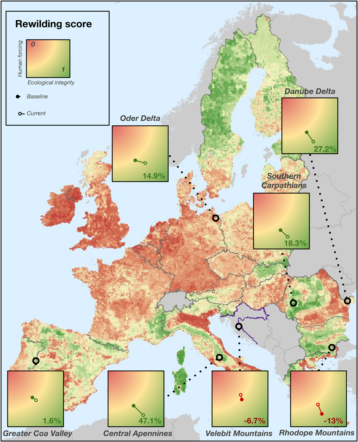
Groundbreaking application Rewilding Europe’s Rewilding Researcher Josiane Segar is studying for her PhD at the German Centre for Integrative Biodiversity Research (iDiv) Halle-Jena-Leipzig’s BioCon group. As the first speaker at the webinar, Josiane presented a new way of evaluating rewilding progress that she has developed, together with Rewilding Europe and other partners. Offering a new and more dynamic perspective compared to traditional monitoring, its groundbreaking application across seven of Rewilding Europe’s operational areas has revealed both positive impact and challenges to upscaling.
The new assessment framework involves 19 indicators – 10 relating to human intervention and nine to ecological health – which together generate a rewilding score for the rewilding area being evaluated. These indicators are typically measured using a combination of expert knowledge and data collected from the field, with the assessment specifically designed to be user-friendly for rewilding practitioners and area managers.
Josiane explained that in applying the new methodology at landscape scale, the study team wanted to look at the potential for upscaling rewilding. This bigger picture approach not only took into account the direct, site-specific interventions of Rewilding Europe’s operational area teams, but also changes happening outside pilot sites. Some or all of these changes may be outside the control of rewilding teams.
Josiane is now aiming to expand her work to cover the assessment of as many European rewilding sites as possible. She has invited European Rewilding Network members to provide data for their respective sites, or to apply the assessment themselves.
A spatial approach
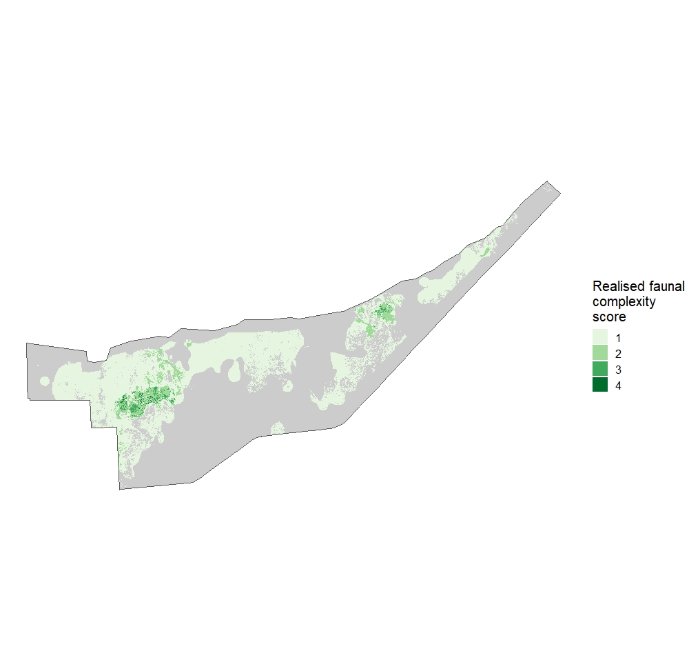
The second speaker was Julia Mata. Working with Rewilding Europe Supervisory Board member Professor Jens-Christian Svenning, Julia has a PhD from Aarhus University (Denmark) – she is also currently working as a European Rewilding Network associate. Addressing the webinar audience, Julia talked about a specialised framework she has developed to monitor the spatial progress of trophic rewilding at rewilding sites, which involves wildlife tracking and remote sensing.
Julia presented her monitoring framework through a case study of a Rewilding Argentina site in South America. The framework uses location points of reintroduced wildlife species and a habitat classification of the rewilding site as the starting point for creating three sets of maps – these show the potential and actual occupation of the site by the reintroduced animals.
Julia’s monitoring framework can help rewilding practitioners visualise and spatially understand the progress of rewilding at their site. It provides information on suitable areas for relevant wildlife species within the site, and to what extent these areas are currently being used. Framework maps, which are easy to interpret, can assist practitioners in the evaluation of areas for further releases or the reintroduction of new species.
By publishing and communicating about her framework, Julia wants to inform practitioners about the possibility of mapping and spatially measuring rewilding progress, and thereby improve rewilding outcomes. She is also working to increase its application by rewilding practitioners who want to understand the spatial distribution of reintroduced species at their sites.
A platform for exchange
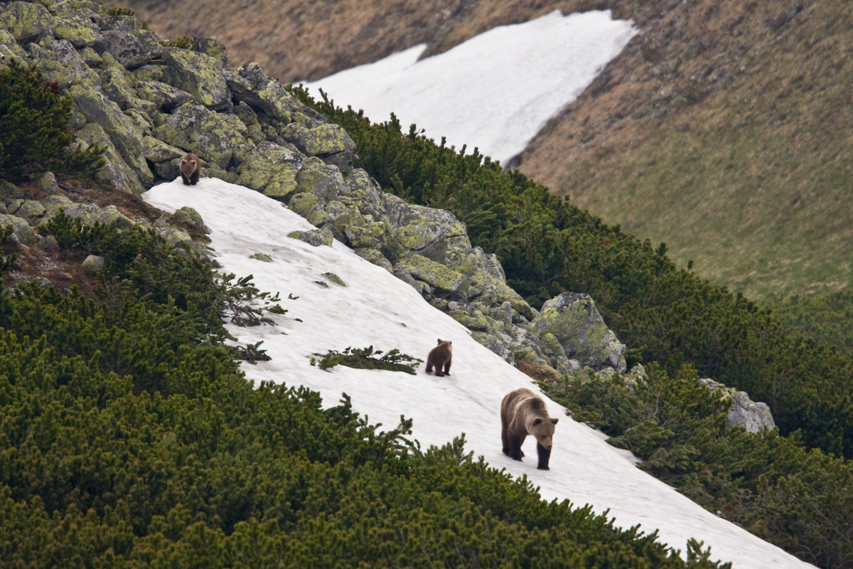
![]() Today rewilding is gaining momentum as a progressive and effective approach to conservation in Europe. Underpinning this trend, the burgeoning European Rewilding Network continues to foster collaboration and amplify results.
Today rewilding is gaining momentum as a progressive and effective approach to conservation in Europe. Underpinning this trend, the burgeoning European Rewilding Network continues to foster collaboration and amplify results.
Founded by Rewilding Europe in 2013, the aim of the ERN is to enhance the efforts of each member by facilitating the exchange of skills, insight and experience. Members meet regularly, usually via webinar, while nature-based businesses can also apply to Rewilding Europe Capital, Rewilding Europe’s enterprise loan facility.
Rewilding Europe extends a warm welcome to all European rewilding initiatives that focus on practical, result-oriented rewilding and encourages them to apply for ERN membership.