
The deployment of EarthRanger software across all of Rewilding Europe’s operational areas will allow rewilding teams to keep better track of wildlife, thereby enhancing rewilding outcomes.
Pivotal partnership
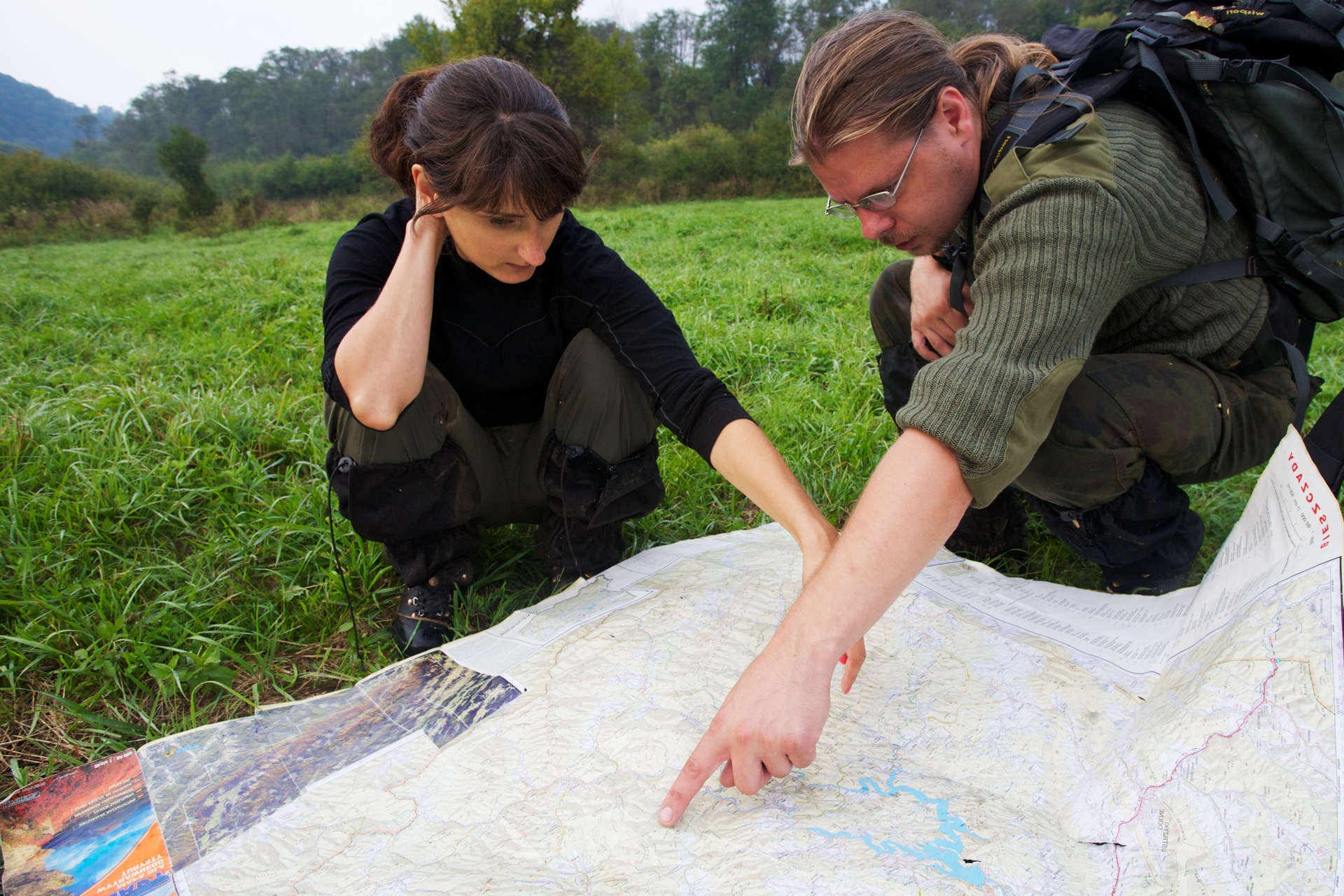
Today, Rewilding Europe’s dedicated and pioneering rewilding teams are taking big steps forward in the field as they work to protect and restore wild nature. But exactly how big? Measuring and continually monitoring rewilding impact is critical if we are to improve decision making and scale up rewilding in the most effective way possible.
 With this in mind, a new partnership between Rewilding Europe and EarthRanger is set to enhance data collection, monitoring and decision making across all of Rewilding Europe’s operational areas.
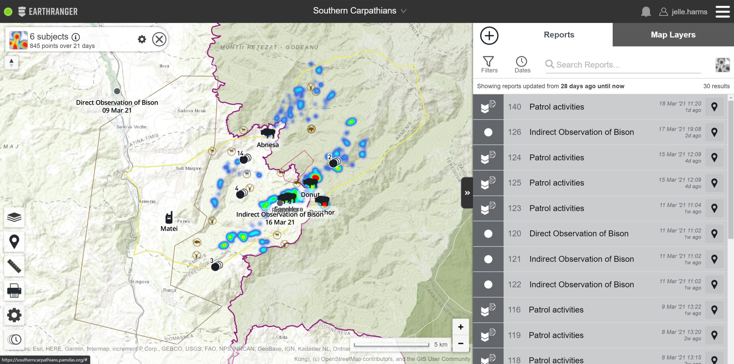
EarthRanger is a user-friendly, online platform, developed by Vulcan Inc. to help protected area managers, ecologists and wildlife biologists stay informed and make better wildlife conservation-related decisions. It has so far been rolled out in the Velebit Mountains, Rhodope Mountains, Greater Côa Valley and Southern Carpathians, with data now regularly uploaded to the system by local rewilding teams. It will be deployed in the remaining rewilding areas in 2021.
A one-stop data shop
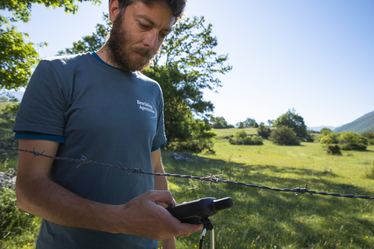
EarthRanger aggregates and displays all historical and real-time data available from a conservation area on a single screen – whether that be information from sensors (including warnings generated by animals crossing virtual fences), camera trap imagery, ranger observations or other spatial field data. This allows those managing and working in protected areas to mitigate threats, promote human-wildlife coexistence, and make better, more informed operational decisions.
“EarthRanger has given us a far greater understanding of our area,” says Marija Krnjajić, team leader of the Velebit Mountains rewilding area in Croatia, which was the first to receive the platform in the summer of 2020. “It has already helped us to coordinate rangers’ activities more effectively and improve our monitoring and reporting through the aggregation of big data from cameras, animal collars and vehicle sensors.”
Protecting iconic European wildlife
EarthRanger was first deployed in Kenya’s Lewa Wildlife Conservancy in 2016. Five years later this invaluable tool is now in use at over 100 sites across more than 30 countries, helping to protect over 650,000 square kilometres and monitor 50 endangered and threatened species and their habitats.
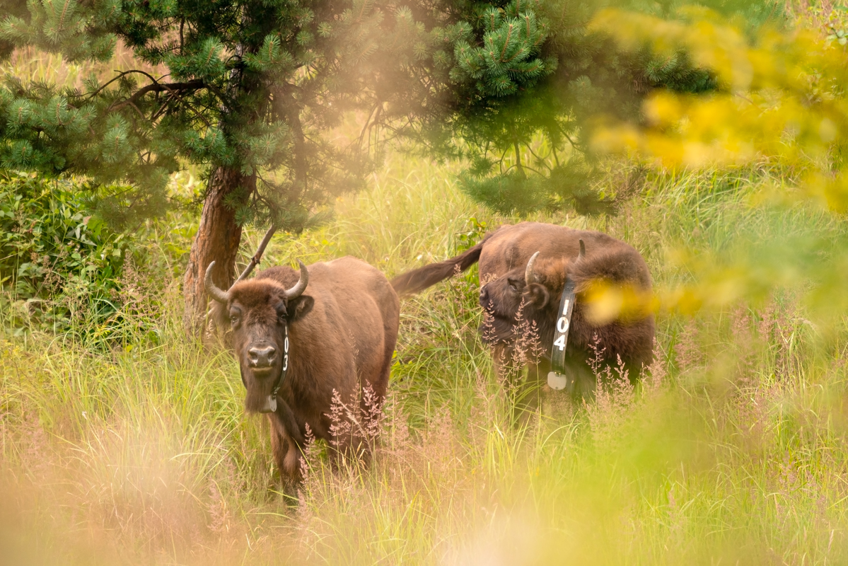
Elephants, rhinos, snow leopards and pangolins are just some of the array of species now being tracked and protected through EarthRanger. As a result of the new partnership with Rewilding Europe, European bison, cinereous vultures, griffon vultures, fallow deer and red deer can now be added to the list of animals being directly tracked (with chamois and pelican soon to follow), while many more will be covered by field observations and reporting.
“We are really excited to be supporting rewilding efforts in Europe,” says Bruce Jones, who works as a partnership manager for EarthRanger. “EarthRanger was initially developed to protect African wildlife. Through our partnership with Rewilding Europe, we are pleased to extend protection to a wide range of iconic European species.”
Empowering and unifying rewilding teams
The rollout of EarthRanger in Rewilding Europe’s rewilding areas is the first time the platform has been deployed in Europe. It comes pre-integrated with Tableau (data visualisation and analysis software), and integrates with ArcGIS (software for storing, managing and sharing geospatial information), which has also been rolled out across Rewilding Europe’s rewilding areas.
“By creating a vast data repository, these three systems will see teams using one holistic approach to rewilding monitoring, intelligence and decision support,” says Jelle Harms, Rewilding Europe’s Geospatial Coordinator. “Together, they will give a very clear picture of what is happening in the field, both in terms of wildlife and habitats, and the development of local nature-based economies.”
Vulcan Inc. is a privately held company headquartered in Seattle, Washington. It was founded by the former Microsoft co-founder Paul Allen and his sister Jody Allen in 1986 to establish and oversee the family’s diverse business activities and philanthropic endeavours.